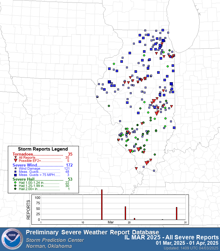
March left Illinois with much to discuss: tornadoes, high winds, and an eerie haze of dust marked one of the most active starts to spring in decades. The month saw 35 tornado reports statewide, making it the second most active March in the past 25 years, trailing only March of 2023, which included the historic tornado outbreak on March 31. Severe weather and gusty winds repeatedly swept across the region, bringing occasional damaging winds to central and northern counties, along with scattered hail across the south.
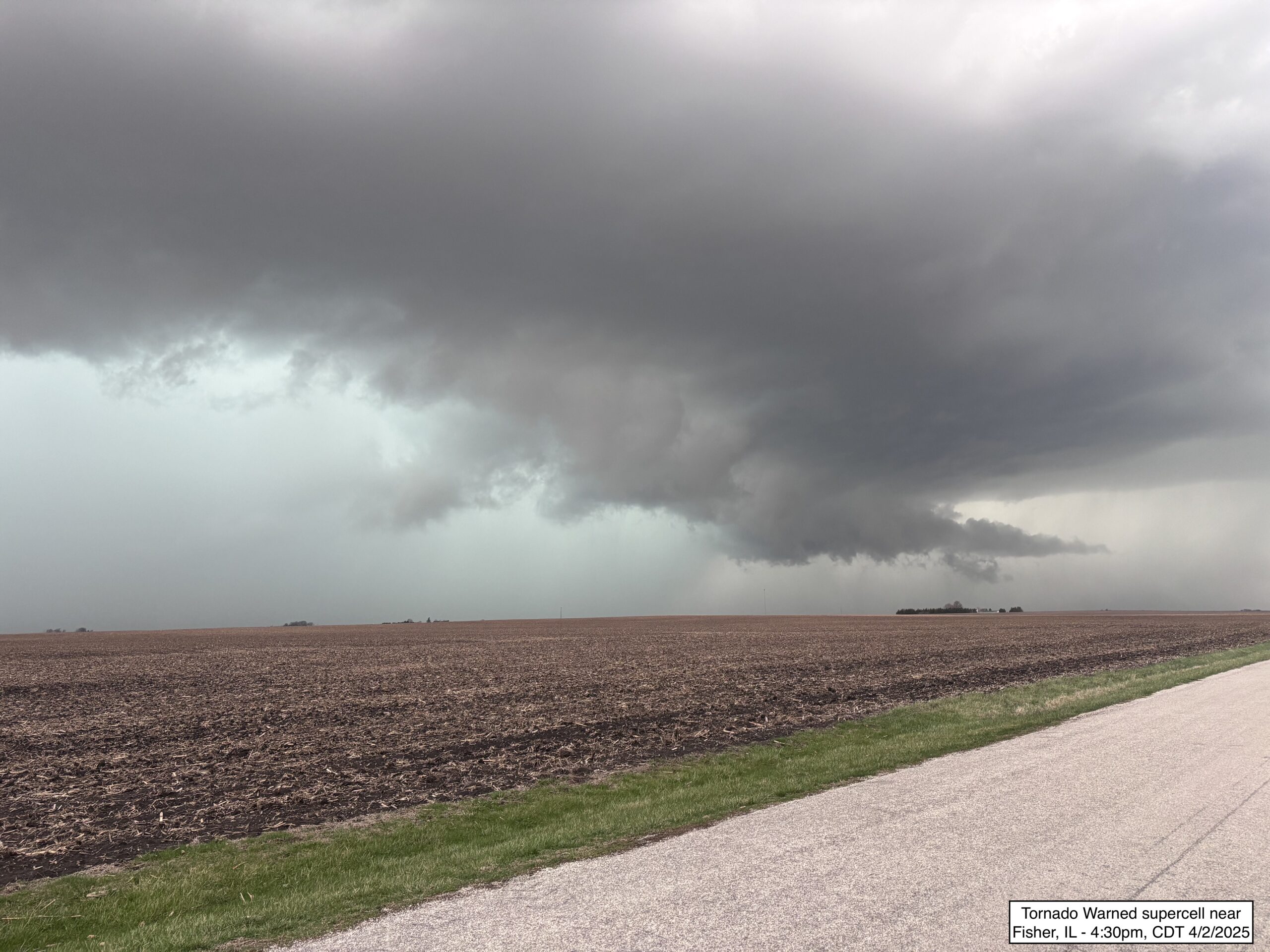
This pattern continued into April, with more than 700 severe thunderstorm or tornado warnings issued on April 2 as a widespread severe weather outbreak unfolded across the Mississippi River Valley. Illinois experienced golf ball-sized hail, damaging wind gusts, and likely multiple tornadoes from Wednesday’s event. That afternoon, I chased a large, electric supercell east of Clinton, IL, that likely produced a rain-wrapped tornado near Loda, IL. Meanwhile, an EF2 tornado caused extensive damage in the northern suburbs of Indianapolis, and Arkansas, Tennessee, and Mississippi endured a significant tornado outbreak, with numerous strong tornadoes and widespread damage reported. The Mid-South is now threatened with widespread flash flooding risks associated with a stalled front draped over the area into this weekend. This week has been, and will be, historically impactful for the region.
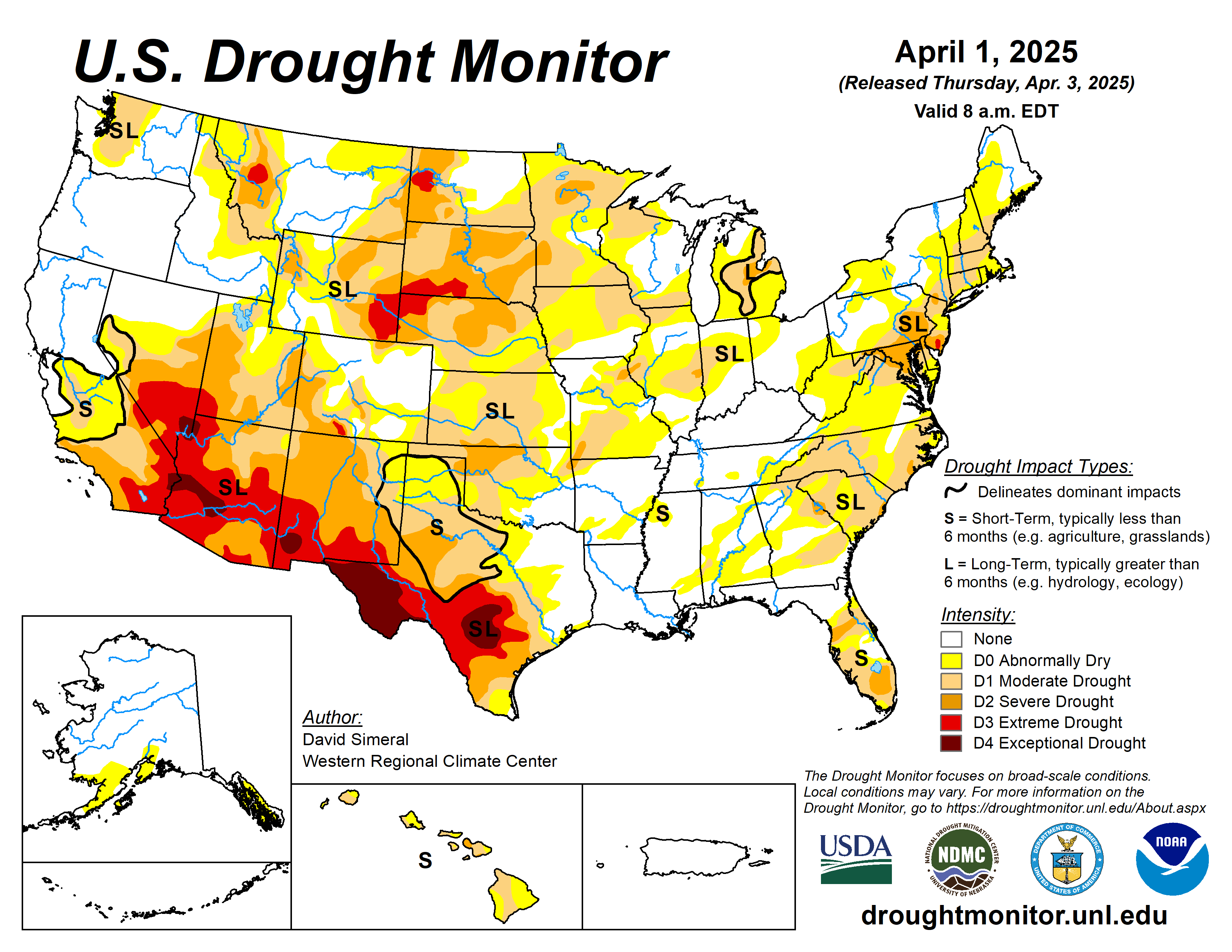
A series of deep low-pressure systems, known to meteorologists as mid-latitude cyclones, fueled the recent severe weather barrage across the Central U.S. These storms, common in March and April, often organize a wide spectrum of weather conditions, including the severe thunderstorms we’ve recently endured. Beyond the more typical Illinois weather, something more unusual caught my eye: dust. On multiple occasions, dust from drought-stricken areas of New Mexico and West Texas was lofted into the air and carried hundreds of miles to the Midwest, producing hazy skies tinged with a yellow hue. The effect was a bit unsettling—something felt off. It served as a visual and physical reminder of the large-scale dryness to our southwest. Dust storms are rare this far north, and their presence underscores the broader regional drought narrative unfolding as we enter the 2025 planting season.
While March storm systems delivered above-normal precipitation to parts of the Upper Midwest, rainfall in Illinois remained seasonal. However, soil moisture profiles tell a different story. The dry finish to 2024 left many fields across the Corn Belt with significant subsoil moisture deficits, some of which have carried over into spring. Recent rains have improved those profiles in the last week.
Looking ahead, seasonal outlooks continue to highlight an elevated risk for severe weather across the Southeast and Midwest. This is partially driven by lingering drought in the Southwest and an above-average snowpack in the Intermountain West, both of which can influence downstream storm tracks and atmospheric instability. That said, the near-term forecast is trending quieter toward mid-April in the Midwest. Next week will also see cooler temperatures and the potential for a deep freeze early in the week.
The question on my mind now, as we look ahead to the climatological peak of severe weather season in April and May, is this: Has the fast start to the season locally set the tone for what’s to come? It may well portend additional watches, warnings, and the familiar howl of civil defense sirens echoing over freshly planted fields in May. With late April and May typically representing the climatological peak of our severe weather season, Illinois farmers may need to navigate narrow planting windows between rain delays and bouts of active weather, some possibly severe. Drier conditions next week could begin to open windows but the relatively cool temperatures in the forecast should keep slowly rebounding spring soil temperatures near critical 50°F thresholds. A late-week warmup could set the stage for an ideal early planting window, especially if the weather stays dry for several consecutive days.
Long-range models hint at a return to a more active pattern by mid-to-late April, aligned with the trends seen earlier this spring. While our forecast confidence is poor beyond two weeks, the ingredients that have supported early-season severe weather—ample moisture, atmospheric instability, and energetic storm systems—are likely to persist.
Adding complexity to the seasonal outlook is the evolving oceanic backdrop. A fading La Niña has begun to transition into ENSO-neutral conditions, and Pacific Sea surface temperatures now resemble patterns historically associated with drier growing seasons in the Central U.S. That’s not a sure forecast of drought, but it is a signal that bears watching. When we pair oceanic analogs with present drought in the Southern Plains and below-average winter snowpack in the Upper Midwest, you begin to see significant sources for early season drought to our West.
Seasonal outlooks from several models (e.g., NMME, CPC, and ECMWF) forecast an increased likelihood of below-normal precipitation extending northward from Texas into the Central Plains and Upper Midwest this summer. Taken together, these factors raise the stakes as we head into a new planting season. The quiet weather expected next week should give the Midwest and Mid-South time to recover and focus more fully on planting decisions and fieldwork. If late April and May bring a return to more frequent severe weather, we’ll be ready.
Matt Reardon


 and then