
May had been quiet across northern Illinois through the first half of the month, producing few storm reports and below-average rainfall. The southern half of the state ran the other way, with regular rainfall intervals choking fieldwork into narrow windows. Last week’s USDA report estimated corn and soybean planting near-to-above 50 percent statewide, and drier conditions late last week reopened the door in those waterlogged southern counties. This week’s progress update should show meaningful gains heading into today’s pattern shift.
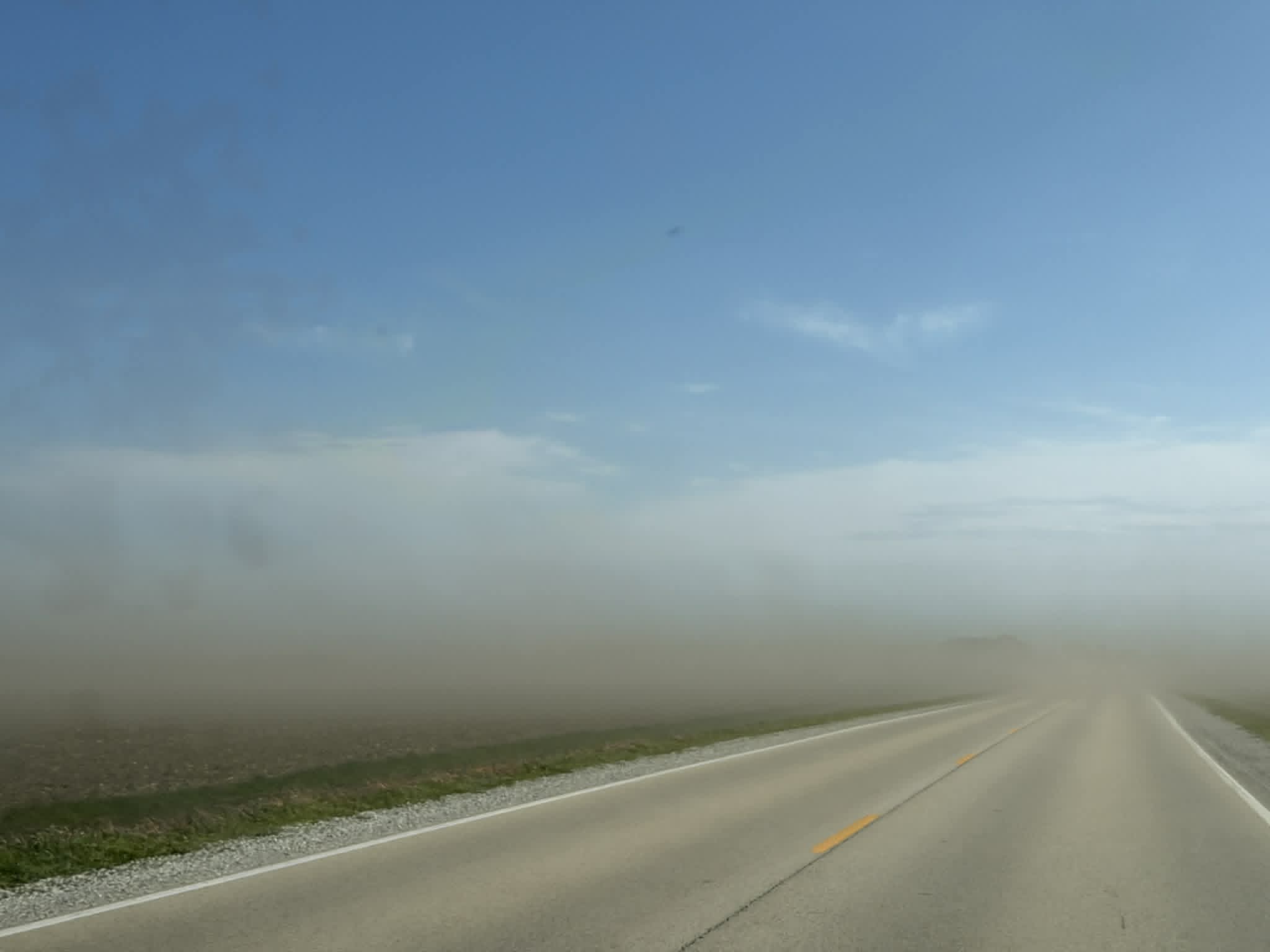
Blowing dust shrouds roadways in Champaign County (5/4/2026) – Andrew Pritchard
That dry window closed this week. Roughly an inch of rainfall fell across much of Illinois Monday, alongside scattered severe wind reports, as warming temperatures and a return of Gulf moisture began fueling late-May thunderstorms across the Midwest. Additional rainfall chances follow through the week. The pattern flips again heading into next week, with warmer and drier conditions returning to reopen fieldwork windows as we transition into June. That warmth should help emerged crops progress nicely into the month ahead.
Dry conditions earlier this spring have brought dust storms back into the forecast. The National Weather Service has elevated dust storm warnings and advisories as priority products in recent years, and offices have issued several this spring on high-wind days when bare, dry topsoil takes flight without an emerged crop to anchor it.
Wind has driven the story again this year. A strong Bermuda High off the East Coast and a sharp temperature contrast between the anomalously warm Mid-South and a cold, snowy Canadian Prairie have kept the Midwest gusty for the second spring running — today’s severe wind reports are the latest entry in that ledger. That wind has compounded a planting season already cramped by the wetter pattern that took hold in April.
Recent rains and cooler temperatures have rebuilt soil moisture profiles across much of the state and pulled drought concerns off the near-term table. Only the counties hugging the Ohio River at the state’s southern tip still carry a drought classification. Drought risk never falls to zero heading into the warm months, but a rapidly strengthening El Niño and a favorable late-May precipitation outlook have my concern level well below where it sat at the start of the year.
June typically marks a transition in how our weather behaves. The sweeping troughs and low-pressure systems that careen from Denver to Detroit grow less frequent, and the pattern slows down. Daily rain chances narrow to uncertain afternoon thunderstorms if we’re lucky, and hot, rainless stretches if we’re not. Years like 2023 tipped to the dry side in early June.
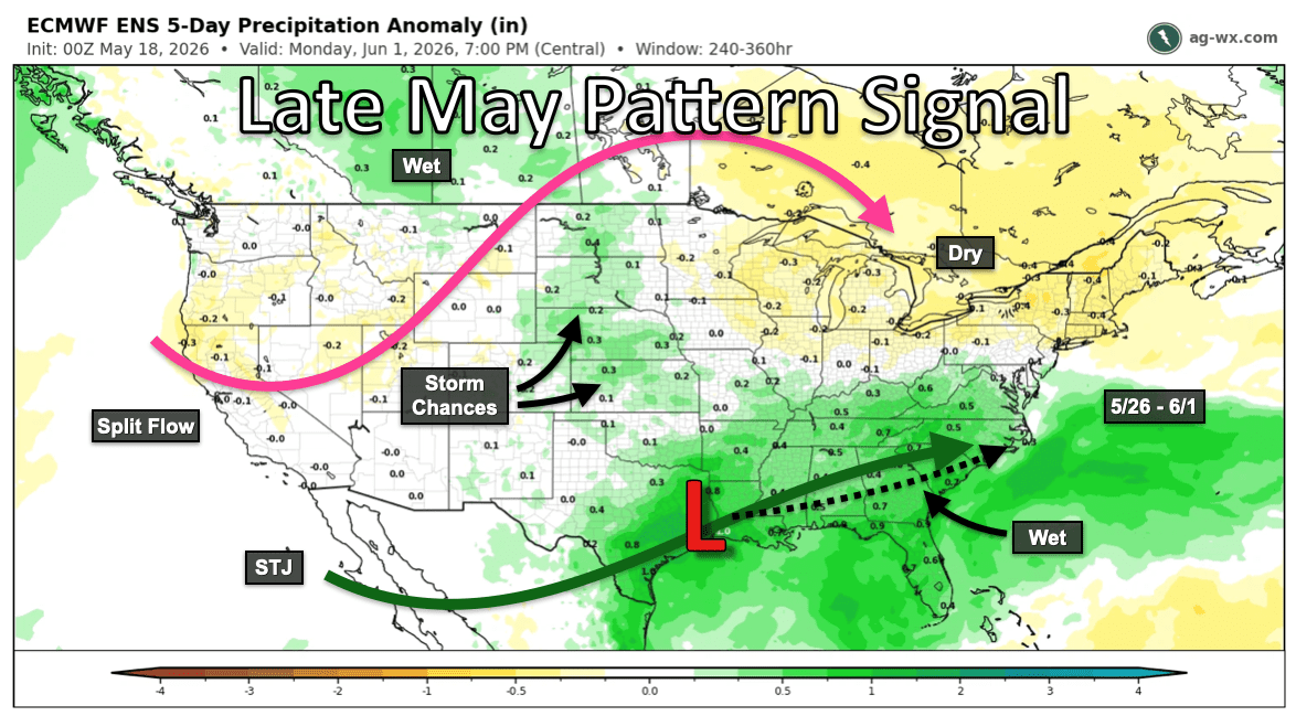
Late May Pattern Signal (ECMWF ENS 5/26 – 6/1)
Long-range forecasts, and any forecasts for that matter, struggle most with these uncertain thunderstorm chances at the peak of our warm season. Numerical weather prediction models post their worst accuracy scores during summer as a result. Without the predictable cold fronts and lows of the cool season to anchor them, they miss the finer-scale nuance of outflow boundaries and gust fronts crawling across the Illinois prairie.
Illinois often leans on Northwest Flow thunderstorms in late June and July to deliver rainfall through our hottest weeks. The good news: this summer’s signals favor an active Northwest Flow regime.
Pacific sea surface temperatures continue to climb quickly, and 2026 is shaping up as a strong El Niño year. What sets this event apart from recent ones, including the 2023 episode that produced early-summer drought locally, is its speed of onset. El Niño usually peaks in winter, when its grip on North American weather patterns runs deepest. The name itself reflects that timing. Peruvian fishermen coined “El Niño,” or “the Christ Child,” after watching ocean temperatures spike in their waters around Christmas. The warmer water carried fewer nutrients, and their winter catch fell off as a result.
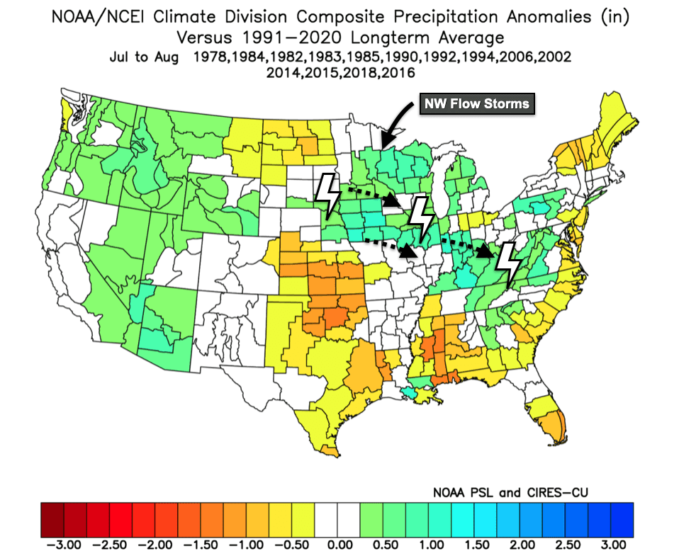
Active East Pacific Hurricane Years Analog for July/August Precip (NOAA PSSL)
This year, the ocean and atmosphere are already running El Niño. The Climate Prediction Center waits on a three-month average of Pacific sea surface temperatures before making the official call, but the atmosphere is not waiting. A strengthened subtropical jet stream, a hallmark of El Niño, has already pumped excess moisture into Texas and the southern U.S. over recent weeks. Drought gripped that same region only a few months ago.
Two analogs stand out for an early, strong event like this one: 1997 and 2015, both among the most powerful El Niños on record. Neither year delivered an especially wet summer across Illinois, but both ran noticeably cooler through what is usually our hottest stretch.
That cooling matters more than it might appear at first glance. When I ran the numbers on our top-yielding local years, late July and early August temperatures outranked precipitation as the strongest predictor. Both factors count, though cool overnight temperatures during grain fill carry the closest correlation with our best yields. If 1997 and 2015 are any guide, the back half of summer could land in our favor.
A second signal points the same direction. El Niños that strengthen early tend to supercharge the East Pacific hurricane season, the storms that form off the Pacific coast of Mexico. Those storms rarely threaten the contiguous U.S., though Hawaii catches one on occasion and remnants can drift into the Southwest and produce flooding. What makes them worth tracking is what they tell us about the broader summer pattern. Since this year’s El Niño is strengthening so quickly, an earlier-than-usual uptick in East Pacific activity (July or August rather than peak season) looks plausible. I pulled the years with well-above-average activity in that basin and found the same signature: wet conditions across the Midwest paired with milder summer temperatures. That is one more piece of evidence pointing toward a cooler, wetter pattern this summer rather than a hot and dry one.
Matt Reardon
matt.reardon@nutrien.com
FIND US ON